
A greater story in context, and an overview in minutes. That was the idea of the Brunings lecture of 2020, based on the research of Kleinhans’ group (also check the group website). Click on the circles, follow the storyline of your interest and see below for brief stories and main conclusions. The storyline texts are fully referenced to their underlying scientific publications (do email the link to Maarten Kleinhans if you can’t get access). Now watch the movies (or go to our youtube channel):
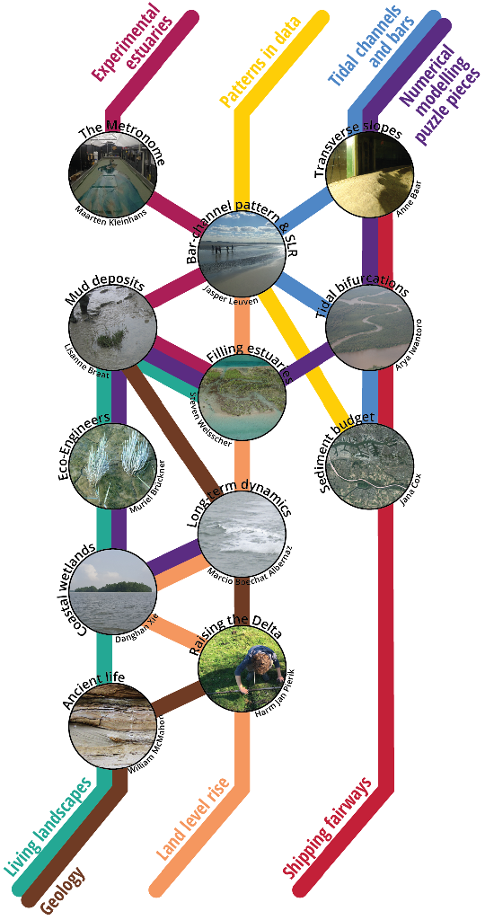
Storylines
The stories behind the lines below contain links to our publications (as far as published). A full list can be found on the website of the PI.
Watch all videos from the storyline Tidal channels and bars.
The resulting living fluvial and coastal landscapes are quite different from landscapes of only sand or gravel. Unlike floodplains in rivers, the unvegetated mud flats in estuaries are bioturbated and mobilized by benthic animals. But similar to rivers, the combination of mud and salt marsh or mangroves narrows channels and stabilizes estuarine flanks, and bar and meander surfaces.
Moreover, vegetation settling and mud flat accretion reduce the tidal prism and limits the size of estuaries, while the size of rivers is mainly determined by flow discharge.
Watch all videos from the storyline living landscapes.
Estuaries without mud flats and saltmarsh or mangroves are incomplete. Crushed nut shell of a range of sizes simulates the suspended mud that is deposited on mud flats. The habitats and eco-engineering effects of river and saltmarsh vegetation are represented by seedlings of five plant species. Flow measurements by particle imaging velocimetry are difficult and experiments are complemented by experimental-scale 2D flow modelling.
Watch all videos from the storyline Experimental estuaries.
In collaboration with Speckmann et al. (TU Eindhoven) a channel network identification code was developed for bathymetries. The resulting networks showed effects of local disturbances such as dredging and disposal but also shoal margin collapses in the Western Scheldt, in numerical models and in the Metronome experiments. Tidal networks have a different character from those in rivers.
We used many datasets of bathymetry, corings and other measurements. Historical maps and satellite images can now be transformed to bathymetries in various ways.
Watch all videos from the storyline Patterns in data.
Many morphological properties of fluvial and tidal systems are determined by the bed slope-driven component of sediment transport, which we studied in detail. The parameterization of this effect determines bar dimensions, degree of braiding, bifurcation development and bend sorting and has major consequences for predicted channel depth and dredging volumes. We made new guidelines to aid model development, pending further process study and model improvements.
Wave-generated morphology on the coast and on ebb deltas results from small spatial gradients in high, multidirectional sediment transport rates. We showed that a novel parameterization for wave asymmetry combined with proper wave climate characterization improves long-term coastal modelling considerably. Suspended sediments behave different from coarser sand.
New mud simulation models were applied to estuaries for formation of mud flats. In the fluvial-tidal transition, floodplain and levees formed with similar morphologies and subsurface stratigraphy as found in the Dutch Holocene coastal plain.
The settling, growth and mortality of live plants and animals affect flow and sediment dynamics in various ways. Building on our earlier riparian vegetation model(also including mud), new codes were developed for saltmarsh and mangroves, for microphytobenthos and for typical macrobenthic species.
Watch all videos from the storyline Numerical modelling pieces.
This raised questions about the role of waves and of vegetation and levee formation on the closure of tidal systems such as the Old Rhine that we studied with experiments and models. In turn, the effects of present eco-engineering species on fluvio-tidal systems raised the question what effects of eco-engineering species of the past were, in particular before and after the evolution of the first land plants. This was studied in outcrops worldwide.
Watch all videos from the storyline Geology.
Watch all videos from the storyline Shipping fairways.
We investigated how natural sedimentation processes formed the present landscapes. Our aims are to understand how controlled reintroduction of floods in embanked areas can raise the land to keep up with relative sea level rise. We studied the palaeography of the Rhine-Meuse delta in general, of the Old Rhine in specific, and of the land reclamation history at the Eems-Dollard estuary, and created filling estuaries in the Metronome and in numerical models.
For tens of estuaries worldwide, we studied the main effects of future sea level rise. Small estuaries will likely have higher flood water levels, but in time their morphology will adapt. Large estuaries will likely lack the sediment to adjust the morphology and loose intertidal habitat. Both problems can perhaps be reduced by more space for the estuary.
Watch all videos from the storyline Land level rise.
Between all the story lines, a picture emerges how estuaries form and function. The processes of sand and mud by currents and waves shape channels, bars and mudflats. Bars, in turn, may force the entire estuary to shape around them. Small-scale plants and animals also modify the bars, banks and form freshwater levees and floodplains, saltmarsh and mangroves. These, in turn, determine the long-term development of estuaries.
The antecedent landscape setting (accommodation space) is the canvass on which filling estuaries form or into which ingressive estuaries erode. Estuaries are limited in growth and may fill up mainly because of the mud and vegetation settling on the limits and on the levees. And the constrained waterscape feeds back to the channel and bar patterns and their dynamics.
On the other hand, dense vegetation may limit the throughflow of mud onto bars and banks in models of saltmarsh, of floodplains, of mangroves and in Metronome experiments.
Some novel conclusions from our projects are:
- Estuaries form at the laboratory scale in flumes that are tilted periodically to create tidal currents. This opens up possibilities for experimentation with controlled environmental variables and settings, with interference such as dredging and disposal, and with mud and live vegetation.
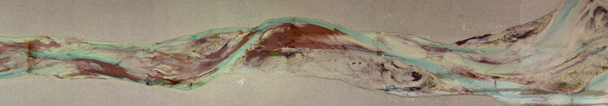
- Tidal bars and bends are similar to river bars and bends in general dimensions. The tides provoke growth of ebb- and flood-dominant channels separated by sills. Tides diminish bar migration, which may cause quasi-periodic narrowing and widening estuarine planforms. The cross-sectional depth distribution is an approximate function of the planform that can be observed from space.
- Local channel dredging and disposal on bars reduce channel dynamics, and reduce intertidal habitat area and smaller channels.
- We can now objectively identify channel networks for detailed analyses and comparisons within and between multi-channel systems.
- Channel depth, bar dimensions and dynamics in numerical models depend critically on a parameter for slope-driven sediment transport. Physically nonsensical values produce natural morphology in long-term modelling, while correct values produce realistic sediment transport in shorter-term modelling.
- Symmetric tidal bifurcations are stable over a larger range of sediment mobility and channel width-to-depth ratio than river bifurcations.
- Mud in sandy estuaries deposits on tidal bars and on the estuarine flanks. This reduces bank erosion and cutting of new channels across bars. The size of an estuary is not only confined by diminished bank erosion, similarly to how floodplains constrain river dimensions. Mud deposition and vegetation also reduce the tidal volume, unlike rivers in which discharge is externally imposed. Moreover, bank erosion is rare; rather, it is channel incision and bend- and bar cutoff that is reduced by mud and vegetation, as we also found in rivers.
- In the pre-vegetation Ediacaran, estuaries were dominated by sand-dwelling macrobenthic species. There was likely less mud than after the evolution of land plants.
- Vegetation also may settle on bars and banks, before or after mud accretion depending on the species. Vegetation has similar effects on large-scale morphology as mud. While increased flow resistance in vegetation promotes expansion, it also lengthens the inundation time in high tide that is unfavourable for plant survival, which is a positive feedback on land level rise.
- Mangrove development is more sensitive to mud concentration than to typical extreme sea level rise. Sea walls enhance sedimentation locally but reduce biodiversity due to the coastal squeeze of habitat under sea level rise.
- How entire estuaries respond to fast sea level rise depends on their size. Small estuaries may show tidal amplification, which increases flood risk. Large estuaries may drown for lack of freely erodible width and available sediment to adjust the morphology.
- The modern Rhine-Meuse delta has turned into an enlarging estuary due to shipping fairway deepening, which causes risks of bed and bank erosion and salinity intrusion.
- The amount of river inflow and sediment supply explains much of the contrasting developments and possible closure of the tidal systems on the Holocene coastal plain of the Netherlands. A positive feedback between tidal volume and vegetated and muddy floodplain formation caused estuary infilling.
For evidence, context and assumptions behind the conclusions, and more insights, see our papers. For recordings of talks in other conferences, see associated movies.
Program 14 January 2020 1-5 pm
13:30 Patterns in the sand: a story about bars, bends, bifurcations and mud
Break: historic map exhibition in the Library
15:00 Living waterscapes and land level rise: a story about past and future
15:45 walk to Earth Simulation Lab for drinks at the Metronome
These are the Brunings2020_lectureslides of the live presentation.